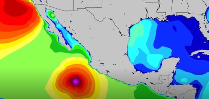
- Hurricane Pamela en route to Mainland Mexico landfall
- Intensifying storm moves ashore near Mazatlan overnight into Wednesday
- Swell for Cabo, Northern Mexico with some windows of decent conditions
Surfers usually get excited about the prospect of a recurving hurricane. The ones in the West Pacific that pull a u-turn off Japan and head into the open North Pacific can send solid swell to the North Shore and the U.S. West Coast. The ones in the Atlantic that hook a right around Bermuda can send pumping waves from the Caribbean to Europe. But in the Eastern Pacific, there’s one big problem with a recurving tropical cyclone recurves: Mexico is directly in its path.
It’s been rather quiet in the East Pacific tropics since Cat 2 Hurricane Olaf made landfall near Cabo San Lucas back on September 10th. And exactly one month since it crossed over the Baja Peninsula, Pamela was named off the coast of Southern Mexico. Pamela strengthened into a hurricane this morning and is on a recurve that’ll bring it inland over Mexico into Wednesday.
The forecast calls for the storm to steadily intensify over the rest of today, bringing it close to major hurricane intensity when it makes an overnight landfall near Mazatlan. The coastal areas between Cabo and Puerto Vallarta see the greatest impacts from Pamela’s wind, weather and waves, but the mountainous inland areas can also expect significant impacts from heavy rains and flooding.
The hurricane will send some swell around the region, too. Lead Pacific Forecaster, Schaler Perry, lets us know what to expect from Hurricane Pamela:


